Turn on Aerial Photography
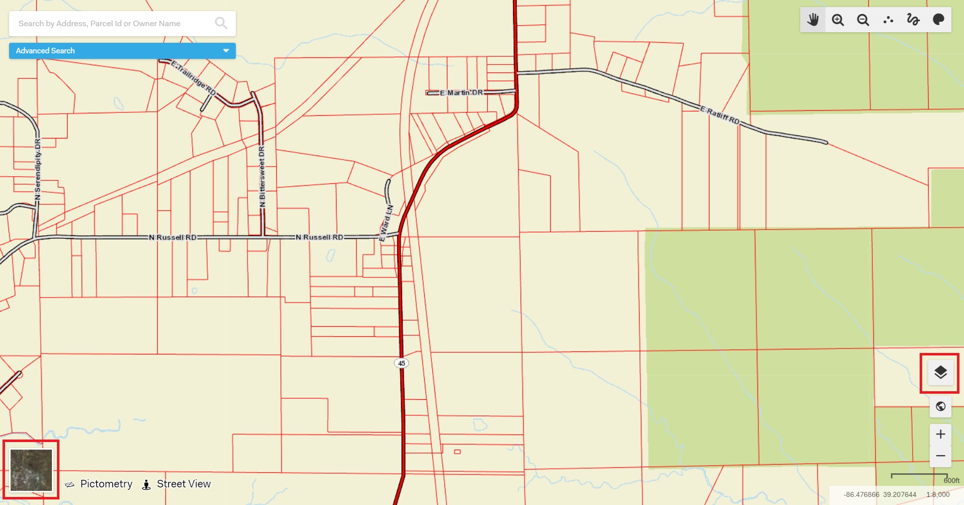
The quickest way to turn on the most recent year of aerial photography is by left-clicking on the square in the bottom left-hand corner of the map. To turn off the aerial photography, left-click on that same small square and the Basemap will reappear.
Another way of turning on the latest year of aerial photography is by clicking on the "Edit Map Contents" button in the bottom right corner of the screen.

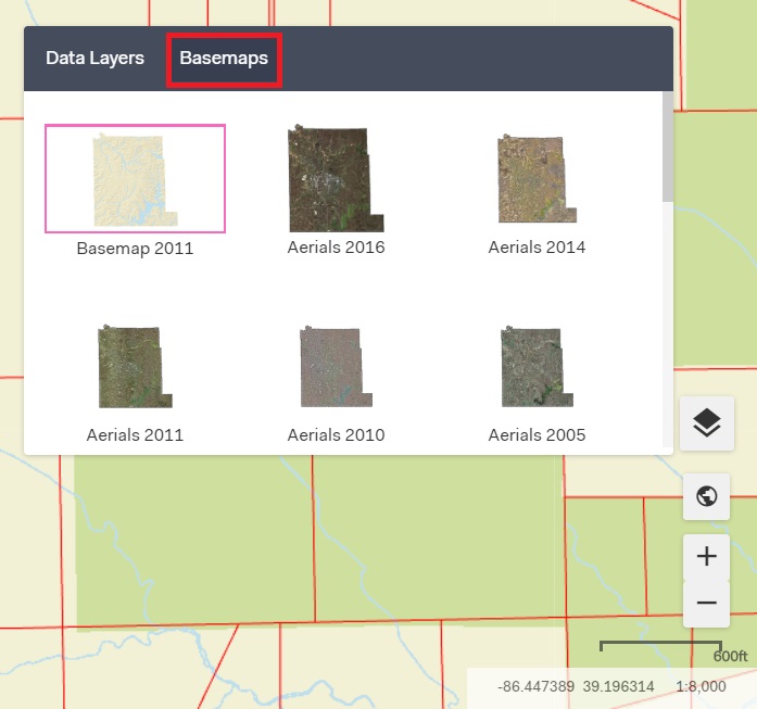
After clicking on the "Edit Map Contents" button, make sure to click on the tab named "Basemaps.”

Here is a listing of standard Basemaps that appear for all Elevate applications:
Imagery
Imagery with Labels
Streets
Topographic
Dark Gray Canvas
Light Gray Canvas
National Geographic
Oceans
Terrain with Labels
OpenStreetMap
USA Topo Maps
USGS National Map